


Post by VeeVee on Dec 27, 2007 6:59:19 GMT -5
Here are more pictures from my trip to Bataan. These ones are from Mt. Samat. Before anything else, I feel this inscribed message at the shrine's marble wall is what this trip is all about and why I'm posting these photos for everyone to see:

A little background info about Mt. Samat for those who don't know. It was the focal point of the Pilar-Bagac line of the Bataan defense in 1942. The mountain dominated over the valley and the Philippine Army artillery threw a curtain of very effective barrage at the Japanese trying to breakthrough the defenses. It was also where the second Japanese offensive concentrated their efforts. Eventually the mountain was neutralized by carpet bombing and artillery barrages, severing communication lines, shrouding the mountain in smoke and burning the foliage with incendiary bombs.
On the way to Mt. Samat.


The shrine at the museum level.


A couple of the mural sculptures. There were more but I didn't photograph all of them.


A couple of plaques dedicated to the various defenders. These two are for the nurses and the 31st Infantry.


The unit dispositions of the defenders around the mountain. I think it's a little too rounded around the mountain. The line was straighter all the way to Orion.


Here's the 155mm GPF that I see in all the other pictures of the shrine by other people. The piece turned out to be facing southeast, away from the battle. It would have been a nice
touch if it had actually faced the defense line. But where it is situated is the best place for it to be at the shrine.


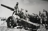
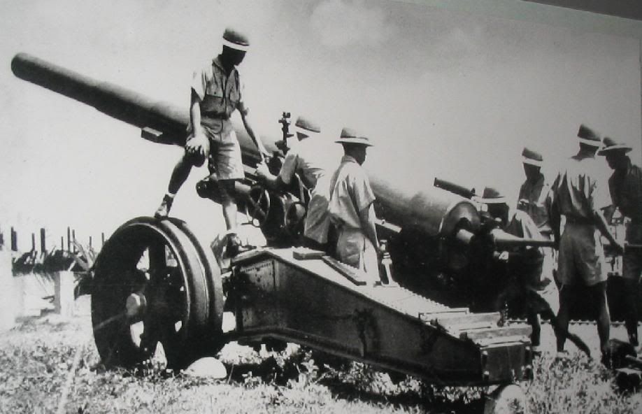
Here is one during its heydays.
The cross.


Base of the cross.


View looking due north. Across is Mt. Natib. This area was the responsibility of the PA 21st Division.

View looking northeast. I think the town of Pilar is on the upper left and Orion the upper right. Somewhere down here is Trail 2 where the sputtering Japanese offensive was stopped by the Philippine army's 41st and 21st divisions.

View looking northwest. This was the 41st division's defensive area.

The kind of jungle terrain some of the fighting took place in.

Looking west toward the I Corp area and the west coast where the Battle of the Points took place.

View of the museum area from the horizontal bar of the cross.

Looking south and southeast. This is where considerable fighting was done by the Philippine Scouts and the American 31st Infantry trying to stem the Japanese tide afer Mt. Samat fell to the Japanese.


The horizontal bar of the cross has a round window on each end. My mom took a picture of me on one of them. I was contemplating what took place 65 years ago.


Leaving Mt. Samat...the sun shining on this now peaceful land. One of the many Death March markers every few miles on the road.


Thank you to all the veterans. Our mission now is to remember.


A little background info about Mt. Samat for those who don't know. It was the focal point of the Pilar-Bagac line of the Bataan defense in 1942. The mountain dominated over the valley and the Philippine Army artillery threw a curtain of very effective barrage at the Japanese trying to breakthrough the defenses. It was also where the second Japanese offensive concentrated their efforts. Eventually the mountain was neutralized by carpet bombing and artillery barrages, severing communication lines, shrouding the mountain in smoke and burning the foliage with incendiary bombs.
On the way to Mt. Samat.


The shrine at the museum level.


A couple of the mural sculptures. There were more but I didn't photograph all of them.


A couple of plaques dedicated to the various defenders. These two are for the nurses and the 31st Infantry.


The unit dispositions of the defenders around the mountain. I think it's a little too rounded around the mountain. The line was straighter all the way to Orion.


Here's the 155mm GPF that I see in all the other pictures of the shrine by other people. The piece turned out to be facing southeast, away from the battle. It would have been a nice
touch if it had actually faced the defense line. But where it is situated is the best place for it to be at the shrine.


Here is one during its heydays.
The cross.


Base of the cross.


View looking due north. Across is Mt. Natib. This area was the responsibility of the PA 21st Division.

View looking northeast. I think the town of Pilar is on the upper left and Orion the upper right. Somewhere down here is Trail 2 where the sputtering Japanese offensive was stopped by the Philippine army's 41st and 21st divisions.

View looking northwest. This was the 41st division's defensive area.

The kind of jungle terrain some of the fighting took place in.

Looking west toward the I Corp area and the west coast where the Battle of the Points took place.

View of the museum area from the horizontal bar of the cross.

Looking south and southeast. This is where considerable fighting was done by the Philippine Scouts and the American 31st Infantry trying to stem the Japanese tide afer Mt. Samat fell to the Japanese.


The horizontal bar of the cross has a round window on each end. My mom took a picture of me on one of them. I was contemplating what took place 65 years ago.


Leaving Mt. Samat...the sun shining on this now peaceful land. One of the many Death March markers every few miles on the road.


Thank you to all the veterans. Our mission now is to remember.


